City Information Modeling Project

Qingdao, China
-
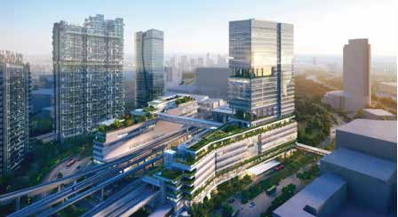
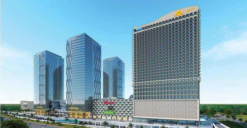
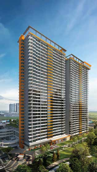
Project Type & Description: CBD (Central Business District)
-
Glodon Products Involved: Glodon City Information Modeling (CIM)
Digitalized Upgrading in Old Urban Areas With CIM
 The core of CIM(City Information Modeling, hereinafter referred to as “CIM”) lies in the management and application of a city’s spatial data. In this case, Glodon sets the CBD (Central Business District) in Shibei District, Qingdao, as its starting point while using the CIM platform to help the old urban areas transform into digitally operated, managed, and maintained ones, thus invigorating the ancient city.
Challenges
i. Urban development management in Shibei District, Qingdao, has become increasingly complicated, with traditional urban governance methods. Operation and maintenance management approaches are inadequate to support the innovative development of the city.
ii. The current intelligent devices are independent, for instance, lamp posts, video monitoring, smart parking, and other business systems, forming an isolated data island and lacking effective monitoring on emergencies in urban governance.
iii. Many inspectors are necessary to maintain various street lamps, lamp posts, utility hole covers, illuminated advertisement boxes, and other public facilities in the region. However, high labor costs lead to insufficiency in maintenance.
Solutions
 With CIM facilities integration management platform, this project has enabled smart transportation, municipal components, intelligent lamp posts, and building economy have been established in the CBD (Central Business District) Phase I. The above intelligent devices are linked to each other and enable real-time monitoring, early warning, etc. In Phase II, this project is planning to integrate applications into this region’s the entire building life cycle(planning, construction, and comprehensive urban governance).
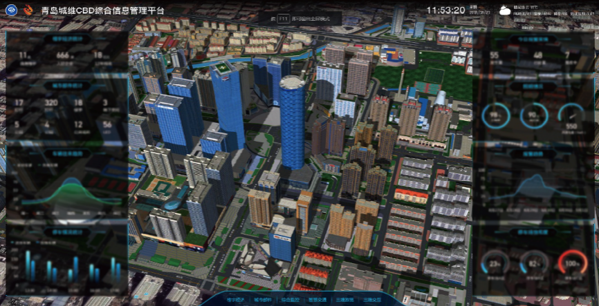
i. City Information Model (CIM) in CBD
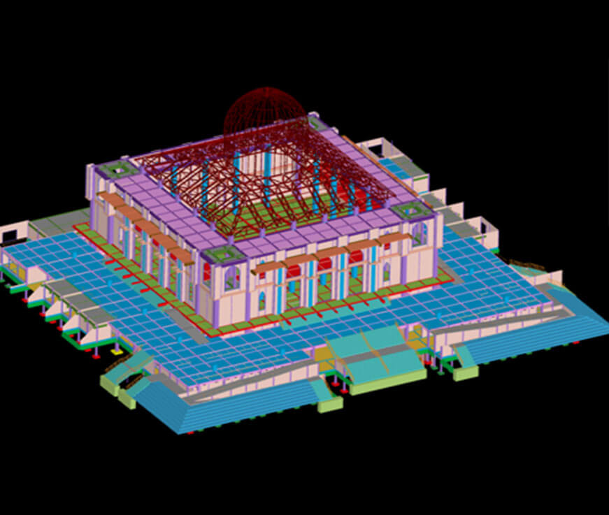
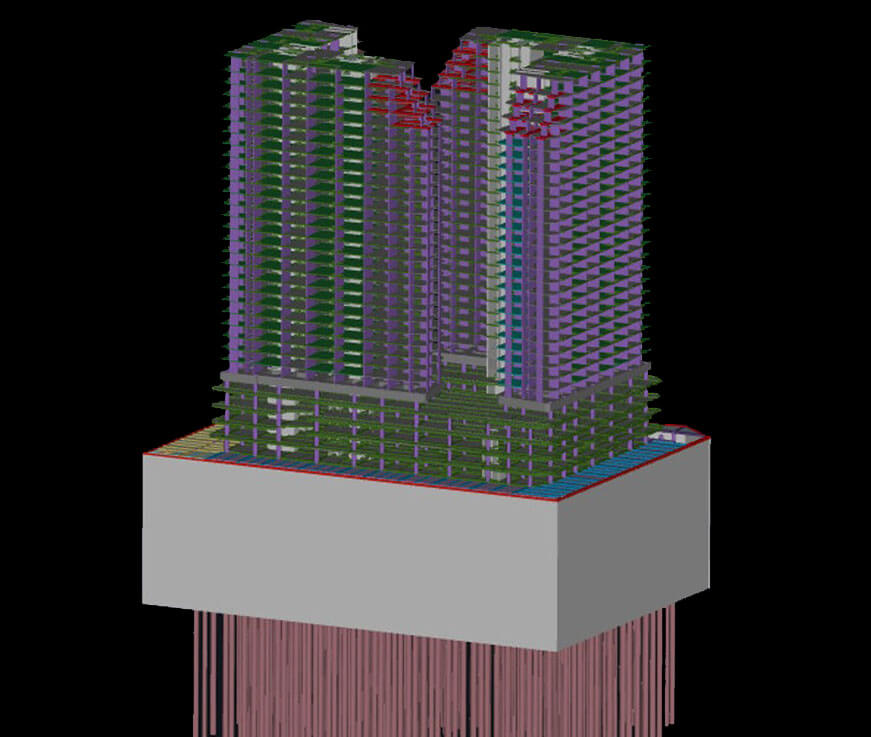
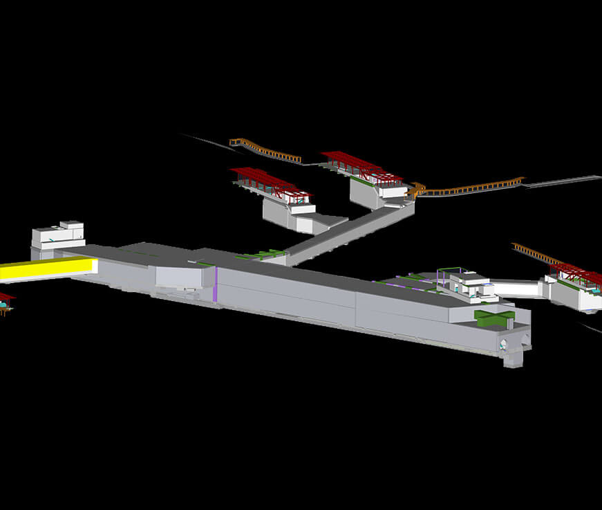
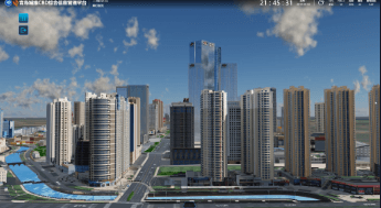
 Underpinned by the BIM+3DGIS technology and the current situation and planning objectives in the area, the project team designed and developed a 3D digitalized model covering 2.46 km² core areas in the CBD (Central Business District) according to CAD, blueprints, and the collecting data at the scene. Based on the maps of satellite images, the 3D model involved information including overground, surface and underground space.
ii. Building a CIM Cloud Platform for Spatio-Temporal Information
CIM Spatio-temporal information cloud platform represents the base and key to attaining a digitalized twin intelligent park. Supported by GIS spatial geographical information of 2D/3D parks while adding BIM information including buildings, overground and underground facilities, plus IoT (Internet of Things) information, a CIM Spatio-temporal information cloud platform of 3D digitalized space is established. Intelligent applications of this area have fully adopted the 3D visualized platform service by integrating macro scene processing and spatial analysis of the GIS and micro complex scene processing and 3D image coloring technologies of the BIM.
iii. Business Administration Systems
 Development and Construction: Based on the CIM platform, while integrating spatial and temporal data, the team can integrate and visualize present these data, supporting decision making of the development and construction. Integrating dynamic data, e.g., video monitoring of major project constructions, is conducive to visual presentation and comprehensive governance of significant progress, security, and quality.
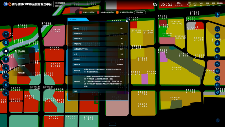
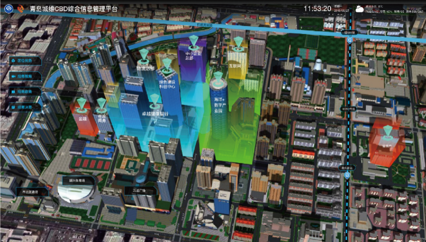 Building Economy: Based on CIM and connecting the settled enterprises in the area and the BIM of the buildings, the project demonstrates the business lanscape of the settled businesses, business information, commercial distribution, and industry proportion as well as vacant space, investment, operation situation, and the existing problems in a 3D visualized way. The project also offers searching tools and multi-dimensional statistical charts. With these efforts, the administrative committee of the region can better grasp the situation of investment and settled enterprises of the buildings and formulate supporting measures in a targeted action.
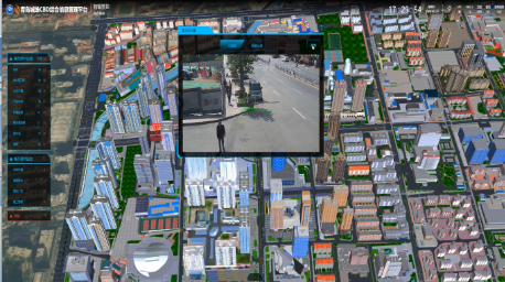
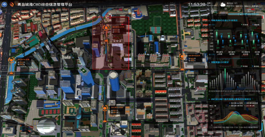 Smart Transportation: The adoptions of AI+ video technologies enable the automatic recognition of the car flow in the area, such as license plates, characteristics of cars, car colors, and car types. Based on the CIM platform, the project comprehensively shows the car flow information, estimates the congestion degree in the warning roads, and achieves the early warning of the transportation and holistic management in the region.
 Holistic Management of Municipal Components: Based on the CIM platform, the project integrates systems including multi-functional intelligent lamp posts, video tracking, and parking guidance in the area. Therefore, it can help achieve online monitoring and management of lamp lighting, video cameras, LED multimedia advertisement screens, parking guidance screens, public broadcasts, and other sub-system equipment.
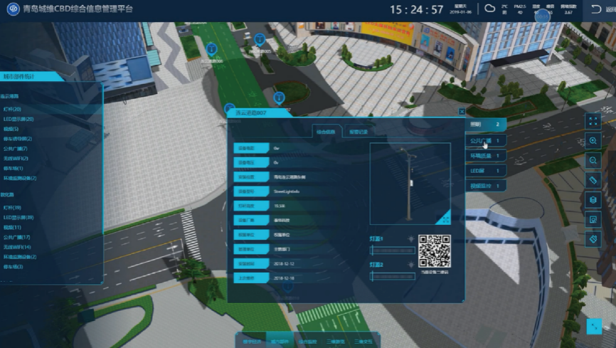 Inspection, Operation & Maintenance of Public Facilities: Based on CIM and mobile internet technologies, the project team efficiently operates and maintains public facilities such as street lights, lamp posts, cameras, and utility hole covers in the district. The application of 3D visualized models, mobile inspection APP, intelligent assignment of tasks, automatic positioning of personnel, QR code, and other methods make intelligent operation and maintenance possible. These can enable quick and accurate sharing of the front and backstage worksheet and the standing book information of the facilities. They have effectively improved the operation, and maintenance efficiency of the public facilities, reduced labor costs by 60% and prolonged the service life of the facilities.
Summary of Benefits
Underpinned by the CIM facilities integration management platform and by integrating technologies like BIM+3DGIS+IoT, the project has rebuilt a digital void corresponding to the actual city in the digitalized space.These innovative actions help the traditional city/park upgrade to a digitalized twin city that is perceivable, dynamic and virtual-real interacted.
i The construction of Phase I and II projects have achieved real-time monitoring of the transportation, city environment, public service, industrial economies, and other park running states, and the prediction and early warning of urban components and O&M needs in the CBD (Central Business District). These will support the decision-making of the holistic governance and the O&M of the region while improving the abilities of ample governing, early warning and quick reacting.
ii The adoption of various technologies such as mobile inspection APP, intelligent assignment of tasks, automatic personnel positioning, and QR code has achieved intelligent operation and maintenance, which has effectively improved management efficiency and service levels.